890 m² industrial roof in CAD, without a ladder
A dimensionally accurate roof plan of 890 m² with elevation levels and every object on the roof, ready two days after the quote.
- Client
- Installer of solar and charging infrastructure
- Location
- Belgium
- Service
- Surveys
- Site type
- Industrial roof with skylights
- Output
- Orthophoto and roof plan in CAD
- Execution
- 2026
The challenge
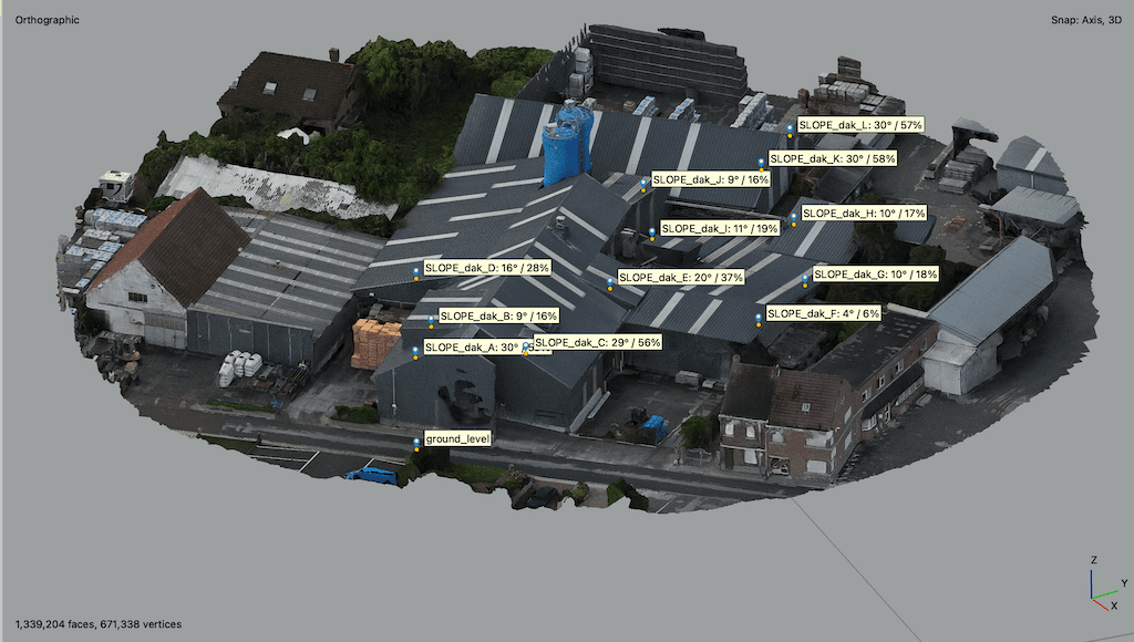
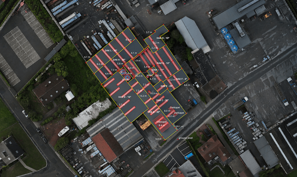
An installer of charging infrastructure, solar installations and battery storage needed the exact dimensions of a roof zone of approximately 890 m² on an industrial site, marked in a KMZ file. Not photos, but a drawing: the outlines of the roof surfaces, the elevation levels and height differences between those surfaces, and every object that could be in the way. Skylights, domes, vents, roof penetrations.
The site is an operating business with truck traffic and customers on the premises. Anyone going onto the roof there with ladders and tape measures stands out and loses time.
Our approach
- Airspace and authorisation. The location lies outside a geozone. The flight fell within the open category, with no application or waiting period.
- Accuracy defined in advance. The survey was carried out with RTK, without ground control points. The relative dimensional accuracy on the roof is better than 2 cm. The position in Lambert 72 is indicative, and the quote states this. Anyone drawing a layout on a roof mainly needs those relative dimensions. Absolute coordinates to within 2 cm require ground control points and are only needed when the drawing must connect to a land surveyor's plan.
- Flying without disturbing the business. The site owner was notified of the flight in advance. Access to the roof or the halls was not necessary.
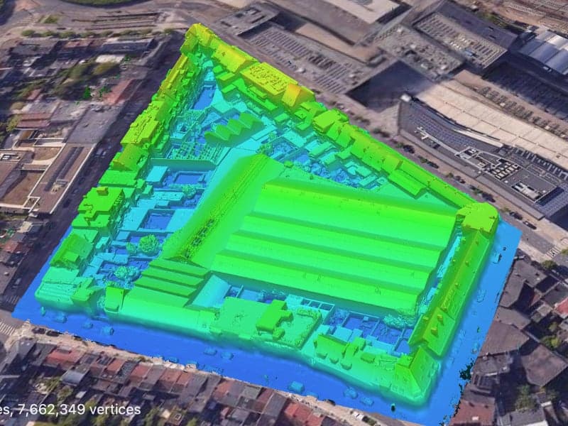
- From images to a measurable model. The images were processed in Agisoft Metashape into an orthomosaic and an elevation model of the roof.
- Drawing. Outlines, objects and elevation levels were drawn on the orthophoto in Lambert 72 and delivered as a CAD file, with one revision round included.
Delivered data
- Orthomosaic (GeoTIFF)
- Roof plan in CAD with outlines, elevation levels and roof objects
Result
| Result | Value | Source |
|---|---|---|
| Surveyed roof zone | 890 m² | Quote |
| Relative accuracy | Better than 2 cm | Contractual specification |
| From quote to drawing | 2 calendar days | Quote and file date |
| People on the roof | 0 | Notification to the site owner |
What the dataset does not demonstrate
The drawing shows where everything on the roof is located and how high. It says nothing about the load-bearing capacity of the roof structure; that assessment is for a structural engineer. The condition of the roofing and its watertightness are also outside its scope. An orthophoto measures the horizontal projection: the true area of a sloping roof surface is that projection divided by the cosine of the slope. Without ground control points, the position in Lambert 72 remains indicative.