Nature management in the port of Antwerp, 50 hectares mapped
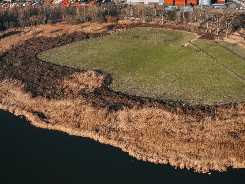
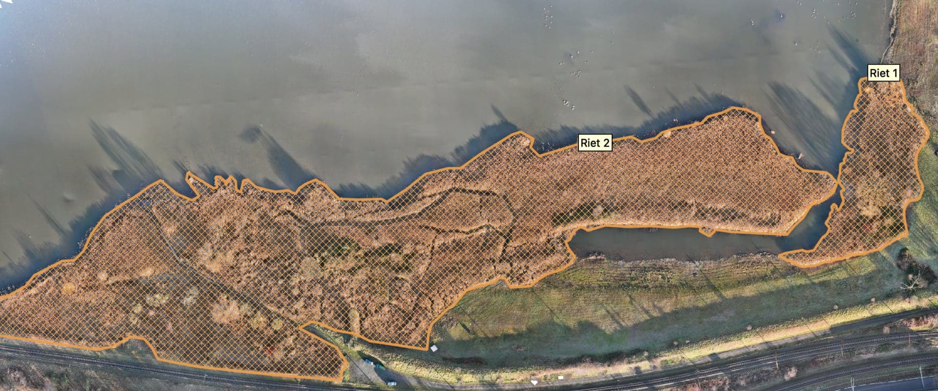
For Natuurpunt Antwerpen Noord & Kempen vzw we mapped 50 hectares of vulnerable nature reserve in the port of Antwerp. The orthophoto and elevation model are used to map reed beds and count cormorant nests, without disturbing the birds.
- Client
- Natuurpunt Antwerpen Noord & Kempen vzw
- Location
- Port of Antwerp
- Service
- Surveys
The question
Natuurpunt wanted to map the reed beds and count the cormorant nests across 50 hectares of vulnerable nature reserve, in the middle of an industrial port environment and without disturbing the nesting birds.
Scope and conditions
Four sub-areas, De Kuifeend, Grote Kreek, Ekers Moeras and Bospolder, together 550,000 m² in port airspace. The flights were coordinated with Port of Antwerp-Bruges and Infrabel.
Approach
Five photogrammetric flights in the Specific category, planned outside the most sensitive periods for the birds, with enough overlap for a continuous orthophoto and an elevation model over the whole area. Total flight time: 85 minutes.
Files delivered
- Orthomosaic (GeoTIFF)
- Elevation model (DEM)
- Nest inventory
- Reed map
Result
- 50hectares
- mapped in one day of flying, with an orthophoto on which individual nests are visible without anyone entering the area.
What the dataset does not show
The orthophoto and the elevation model show the visible situation on the day of flying. They do not show nests under dense canopy, do not identify species and do not replace field observation. The ecological interpretation remains with Natuurpunt.
Thanks to this drone technology, Natuurpunt can now take decisions based on razor-sharp imagery and exact measurements of the reed beds.
Natuurpunt Antwerpen Noord & Kempen vzw