

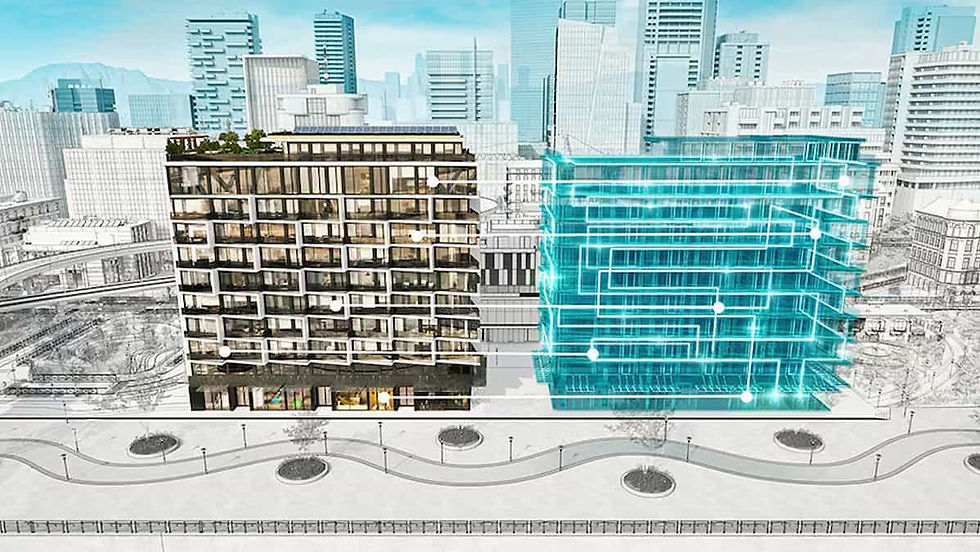
We provide reliable reality capture for BIM, with consistent coordinates and versions that match your model.
Why you should think about drone technology?
Reality capture with RTK/PPK
Consistent coordinates and metadata
Versions suitable for clash checks
Export to Revit and Navisworks
The advantage of working with HOVVR
Model certainty
Current state-of-the-art with centimeter accuracy for validation and clash detection.
Repeatable process
Fixed workflows and naming for predictable updates.
Coordinate management
GCP and local geoid ensure that everything is correct in your reference system.
Certified Partner
A Belgian operator that understands local regulations and is quickly available throughout the country (and the EU).

Clear datasets that effortlessly connect with your BIM agreements and CDE.
Intake
Record LOD, coordinates and delivery formats according to the BIM implementation plan.
Flight plan
Establish reference points and GCP. We ensure the repeatability of measurements.
Processing
Registration, georeferencing and quality control with report.
Delivery
Files and changelog. Version ready for model update.